If your perfect day includes a sunrise walk by a lighthouse or an afternoon swim at a sandy cove, Cape Elizabeth delivers. You want quick access to beaches and trails plus a year‑round neighborhood vibe. With most homes owner‑occupied, about 88 percent by the latest census, you’ll feel part of a stable community rather than a seasonal scene. This guide shows you where to live for the easiest beach and trail access, how the Cross Town Trail ties it all together, and what to expect from the housing stock. Let’s dive in.
How the Cross Town Trail connects everything
Cape Elizabeth’s outdoor life is organized around the Cross Town Trail, an approximately 8.0 to 8.2 mile route that links Portland Head Light at Fort Williams to Kettle Cove and Crescent Beach. The trail threads through Robinson Woods, Great Pond, and the town center area, with mile markers, boardwalks, and posted etiquette. Use it for a morning run, a bike to the beach, or a family walk. You can preview the full route in the Cape Elizabeth Land Trust’s Cross Town Trail guide and map in the official PDF.
- Start or finish at Fort Williams by Portland Head Light for cliff views and short loops.
- Cut through Robinson Woods and Great Pond for scenic inland segments.
- End at Kettle Cove or Crescent Beach for sand, paddling, and summer lifeguards. Check Maine State Parks for current hours and fees.
Fort Williams and Shore Road
Outdoor access
Fort Williams Park is the town’s signature coastal park with broad lawns, picnic spots, rocky shore paths, and the Portland Head Light museum and gift shop. It is a popular place to meet for a short cliff walk or to catch the Cross Town Trail on the northeast end. Expect more visitors in peak season and heavier parking demand on sunny summer days.
- Learn about the park and events on the Portland Head Light site.
- The Cross Town Trail map shows how this area ties into the rest of town.
Homes and everyday living
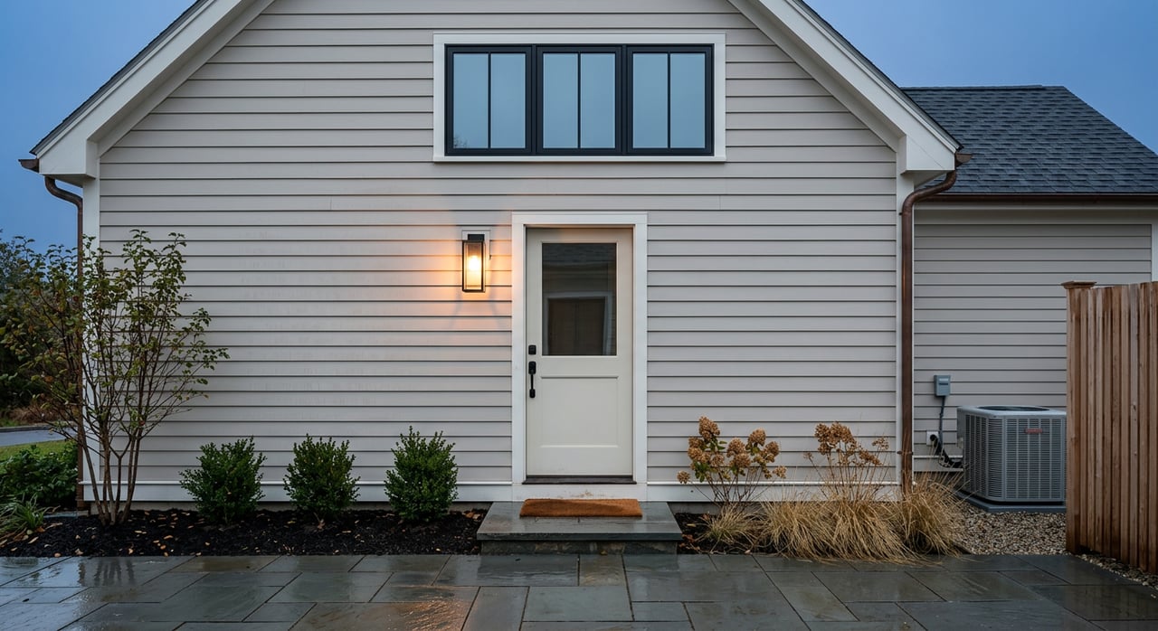
Streets along Shore Road and nearby lanes offer a mix of historic New England homes, shingle and colonial styles, and high‑end rebuilds. Ocean views command premiums, and some parcels front the water. Day to day, you get easy park access and scenic walks, with a bit more foot traffic when the weather is perfect. Prices reflect proximity and views, ranging from well‑kept year‑round cottages to multi‑million dollar oceanfront properties.
Two Lights headland area
Outdoor access
Two Lights State Park sits on a rocky headland with sweeping ocean views and short coastal trails. It is ideal for quick hikes, picnics, and photography rather than sandy swimming. Neighborhood streets near Two Lights connect to park entrances and smaller shoreline paths. Always use caution along cliffs and watch tide conditions. For seasonal hours and updates, refer to Maine State Parks.
Homes and everyday living
Along Two Lights Road and nearby streets you’ll find modest seaside cottages and year‑round single‑family homes, with values influenced by view corridors and lot size. Buyers choose this area for the headland scenery and the simple walk or bike to the park. Current listing snapshots town‑wide suggest inland homes can appear from the mid 400s into the low 1 millions, with higher prices closer to the coast and for direct views.
Crescent Beach, Kettle Cove, and Bowery Beach Road
Outdoor access
Crescent Beach State Park is the classic sandy option, about a mile of beach with a playground, bathhouse, and lifeguarded swimming in summer. Right next door, Kettle Cove offers a quieter shoreline, rocky ledges, and a short loop trail. You can park at the state facilities and link to the Cross Town Trail for a longer outing. Always confirm hours, seasonal lifeguards, and day‑use fees on the Maine State Parks site.
- For maps and parking context in this stretch of coast, see the Maine Coastal Public Access Guide (Scarborough to South Portland section).
Homes and everyday living
Close to the beach you’ll see cottage‑style homes, some seasonal and many updated for year‑round use. Farther inland along Bowery Beach Road and up Ocean House Road, lots tend to grow and homes lean more toward conventional year‑round living. Prices vary widely by size, condition, and proximity to the sand, from modest beach cottages into higher‑value oceanfront parcels.
Pond Cove, Great Pond, and Robinson Woods
Outdoor access
This central corridor is where trails, schools, and daily errands meet. Robinson Woods is a roughly 198‑acre preserve with varied woodland paths, and Great Pond features boardwalk segments and calm water views. The Cross Town Trail passes near the high school, Pond Cove’s small commercial node, and multiple Cape Elizabeth Land Trust properties. It is an easy place to build an everyday walking routine.
- See the Cross Town Trail guide for route specifics and trail etiquette.
Homes and everyday living
Neighborhoods around Pond Cove and Great Pond are primarily single‑family homes on conventional suburban lots. Many residents choose this area for year‑round convenience to schools and the town center. Owner‑occupancy is common in Cape Elizabeth overall, which supports a stable neighborhood feel. For neutral planning context, review the town’s comprehensive plan resources.
Quick buyer checklist for beach and trail living
Use this short list to stress‑test any address you are considering.
- Cross Town Trail test. How easily can you reach the trail from your door, and how far is it to your preferred park endpoint? Start with the CELT map.
- Park operations. Before a summer purchase, check Maine State Parks for current hours, fees, and lifeguard dates at Crescent Beach and Kettle Cove.
- Fort Williams seasons. Expect higher visitor traffic on blue‑sky weekends. If you value quiet, visit the block at peak time before you buy.
- Parking and guests. Confirm on‑street parking rules near parks for your own cars and for visiting friends in summer.
- Flood and insurance. For coastal or low‑lying properties, review FEMA’s Map Service Center to identify any flood zones and discuss insurance with your lender.
- Trail etiquette and dogs. CELT notes stay on trails, pack out trash, and respect leash guidance. This protects access across private easements.
What to expect on pricing
Cape Elizabeth spans a wide range. Inland single‑family homes often show up from the mid 400s to around the low 1 millions, while oceanfront or large view parcels can reach several millions. As a rough reference point, public market snapshots place the area near an average around 830 thousand, but real‑time values vary by street, lot size, and condition. Always verify current pricing with live MLS data when you are ready to tour and write offers.
Ready to find your best basecamp for sand and trails in Cape? Connect with the partner‑owned team at Waypoint Brokers Collective for a local strategy, on‑the‑ground neighborhood insight, and a calm, sustainable approach to buying.
FAQs
What is the Cross Town Trail and how long is it?
- It is an approximately 8.0 to 8.2 mile route through Cape Elizabeth that links Fort Williams to Kettle Cove and Crescent Beach. See the official PDF map from the Cape Elizabeth Land Trust for details.
Which Cape Elizabeth neighborhood is best for sandy beach access?
- The Crescent Beach and Kettle Cove area offers the most direct access to a mile‑long sandy beach and a quieter cove. Check Maine State Parks for current hours and season specifics.
Where can I find cliff walks and lighthouse views?
- Fort Williams Park by Portland Head Light has short rocky shore paths and lookouts, while Two Lights State Park features headland trails with panoramic ocean views.
Are there public fees or passes for Cape Elizabeth beaches?
- Maine State Parks operate Crescent Beach and Kettle Cove and typically collect day‑use fees during the main season. Always confirm current fees and lifeguard schedules on the Maine State Parks site.
How busy do neighborhoods near Fort Williams get in summer?
- Streets closest to the park see more pedestrian activity and seasonal parking pressure on peak days. Visit at midday on a sunny weekend to gauge your comfort level.
Are there off‑leash areas for dogs on Cape Elizabeth trails?
- Dog rules vary by segment. The Cross Town Trail guide outlines etiquette and leash expectations, including sections across private easements where leashes are required.
What should coastal buyers in Cape Elizabeth check for flood risk?
- Use FEMA’s Map Service Center to review official flood maps for any property under consideration and discuss insurance implications with your lender.
What is the general housing mix near schools and town services?
- The Pond Cove and Great Pond corridor features primarily single‑family homes on conventional suburban lots with easy access to schools and local shops. For neutral planning context, review the town’s comprehensive plan materials.
Portland Head Light and Fort Williams Park
Cross Town Trail official guide and map (PDF)
Two Lights, Crescent Beach, and Kettle Cove updates
Maine Coastal Public Access Guide PDF
Cape Elizabeth Census QuickFacts